How Climate Change Worsened Nepal's Deadly Mountain Collapse
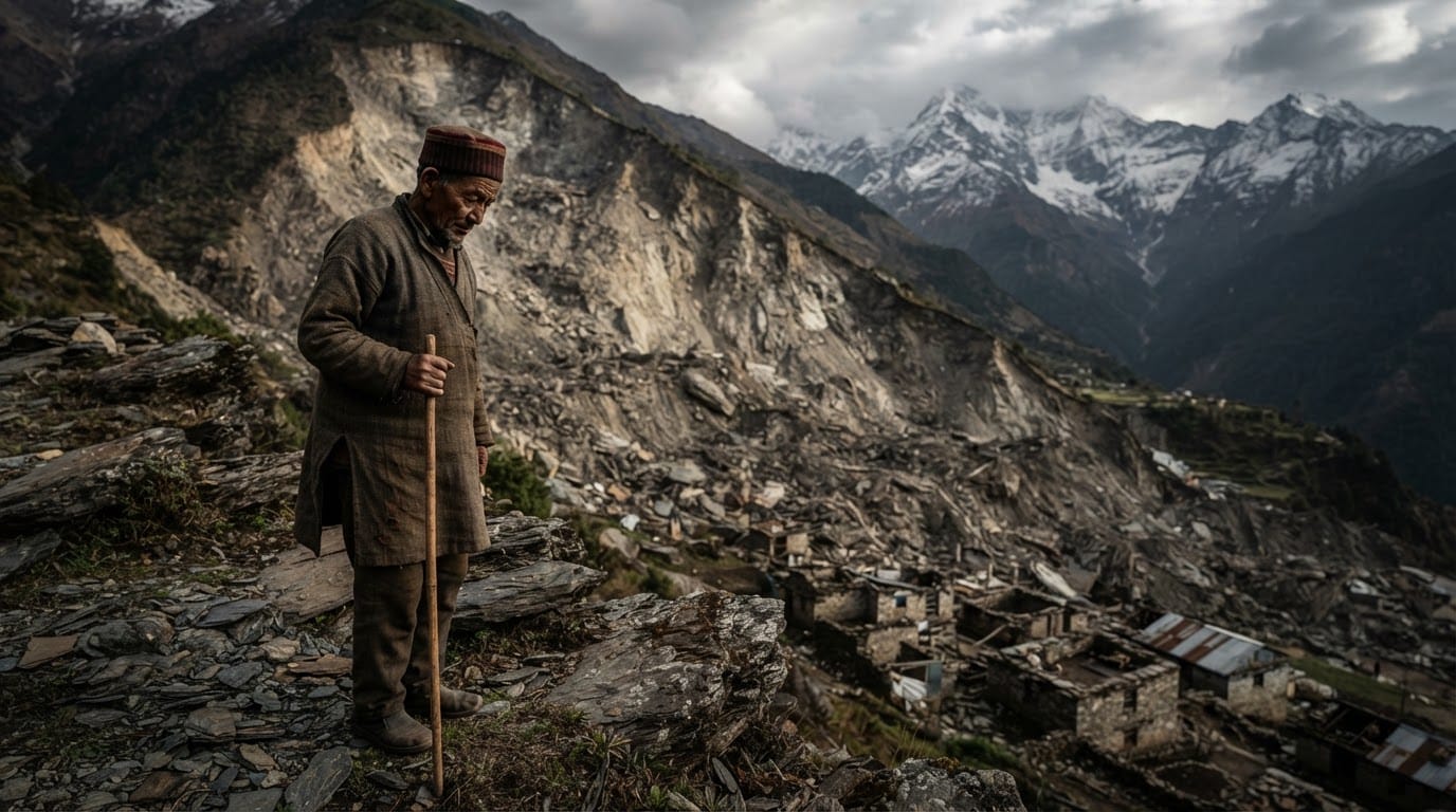
A colossal collapse of rock and glacial ice in Nepal’s high Himalayas unleashed a lethal torrent of debris and floodwaters down narrow mountain valleys, leaving more than 1,300 people dead and over 5,000 others missing. While high-altitude mountains have always produced occasional landslides, scientific investigations reveal that human-induced global warming laid the groundwork for the catastrophe by quietly eroding the structural integrity of the mountain face over decades.
The disaster struck near the border of Nepal and China when a high-altitude slope gave way along the north face of Langtang Lirung. The failure sent roughly 110 million cubic meters of rock and hanging glacial ice plunging down steep terrain, an impact so violent it registered as an earthquake on seismic sensors. Downstream communities, hydropower installations, and transport networks were engulfed in minutes as a wall of semi-frozen slurry raced through river corridors.
Decades of Thawing Weaken the Himalayan Spine
High-altitude mountain slopes depend heavily on sub-zero temperatures to remain stable. Permafrost—soil, sediment, and fractured rock permanently frozen together—acts as geological glue, binding vertical rock walls and supporting glacial masses. When that ice melts, friction between rock layers drops while internal water pressure rises.
Scientific assessments have revealed that decades of rising global temperatures pushed the high Himalayan zero-degree boundary steadily higher, rising by an estimated 100 meters each decade. This shift exposed bedrock that had remained frozen for thousands of years to above-freezing conditions.
Glaciers across the region have experienced accelerated thinning and retreat. In the sector surrounding the failure site, glacial retreat expanded sharply in the recent decade, stripping away millions of tons of ice that previously braced the sheer rock faces. Without that structural counterbalance, deep cracks formed within the mountain core. While geological instability from major seismic events, including Nepal's powerful 2015 earthquake, originally fractured parts of the range, warmer atmospheric conditions transformed stable slopes into precarious hazards waiting for a trigger.
A Chain of Extreme Climate Drivers
The collapse was not the product of a typical localized cloudburst. Instead, researchers identified a compound chain of climate anomalies leading directly to the event. The months preceding the collapse were characterized by the warmest July and August on record across the local Himalayan terrain, with regional warming adding an estimated 1.5 degrees Celsius compared to pre-industrial benchmarks.
In late August, temperatures spiked well above the decade-long average, accelerating snowmelt and sending deep meltwater fissures through the remaining glacial ice. This acute warmth followed unusual weather patterns from the prior year, including unseasonal late autumn snowfall that accumulated heavy drifts across high elevations.
When the rock face separated at an elevation exceeding 5,000 meters, it plummeted nearly 1,400 vertical meters into the valley. The kinetic energy pulverized glacial deposits on the valley floor, liquefying millions of cubic meters of frozen debris. The resulting slurry surged down the Trishuli River basin at speeds exceeding 100 miles per hour, leaving no time for residents to escape.
Overwhelmed Defenses in Narrow River Valleys
The catastrophe has exposed the sharp limitations of traditional adaptation and early warning systems in high-altitude environments. Nepal has expanded meteorological warning stations, community-level disaster drills, and river flood gauges in recent years. Yet these tools are primarily designed to respond to slow-rising monsoon floods or predictable rainstorms, not high-velocity avalanches of rock and liquefied ice.
The geographic reality of Nepal’s mountain terrain leaves communities acutely exposed. Narrow river valleys are the only viable corridors for highways, trade hubs, schools, and homes. They are also the economic lifeblood of the country’s energy sector, hosting major hydroelectric projects that tap glacial runoff.
When the debris flow tore through the Trishuli corridor, it shattered bridges, severed border trade routes, and smashed infrastructure projects. Economic losses from the destruction of property and infrastructure have reached billions of dollars, striking a heavy blow against a developing economy that produces only a tiny fraction of global greenhouse gas emissions.
The Challenge of Monitoring Invisible Hazards
A fundamental challenge confronting mountain geologists is the sheer scale and remoteness of the Himalayan range. Across the Himalaya-Karakoram belt, more than 40,000 glaciers span borders and rugged terrain, yet fewer than 50 receive direct scientific ground monitoring.
Satellite monitoring has improved hazard detection, but it often struggles to penetrate subterranean permafrost changes or identify deep-seated thermal fractures beneath sheer rock faces. Unlike surface glacial lakes, which can be measured and physically siphoned off to reduce flood risk, thawing permafrost deep within high cliff faces cannot be stabilized through engineering solutions.
Researchers emphasize that the physical destabilization of mountains occurs on a generational delay. The heating absorbed by rock walls and glaciers over recent decades will continue to propagate deeper into the rock mass, meaning further failures could occur even under stabilized temperatures. The situation creates an ongoing dilemma for land planners, who must balance the immediate economic necessity of river valley transit and energy generation against the mounting risk of spontaneous mountain collapse.
Looking Forward
The catastrophic failure along Nepal’s Himalayan frontier represents a dangerous shift in the nature of mountain hazards. What once seemed like immovable geological landscapes are proving dynamic and vulnerable under rapid warming.
Protecting downhill populations will require a fundamental reassessment of high-altitude risk, including expansive hazard mapping, more resilient infrastructure setbacks, and improved international funding for loss and damage. However, as long as rising global temperatures continue to push the mountain freezing line upward, the subterranean ice binding the world's highest peaks will keep thawing, transforming the natural foundations of the Himalayas into persistent hazards for millions living below.