The New Guardians: How AI and Satellites are Revolutionizing the Fight Against Wildfires

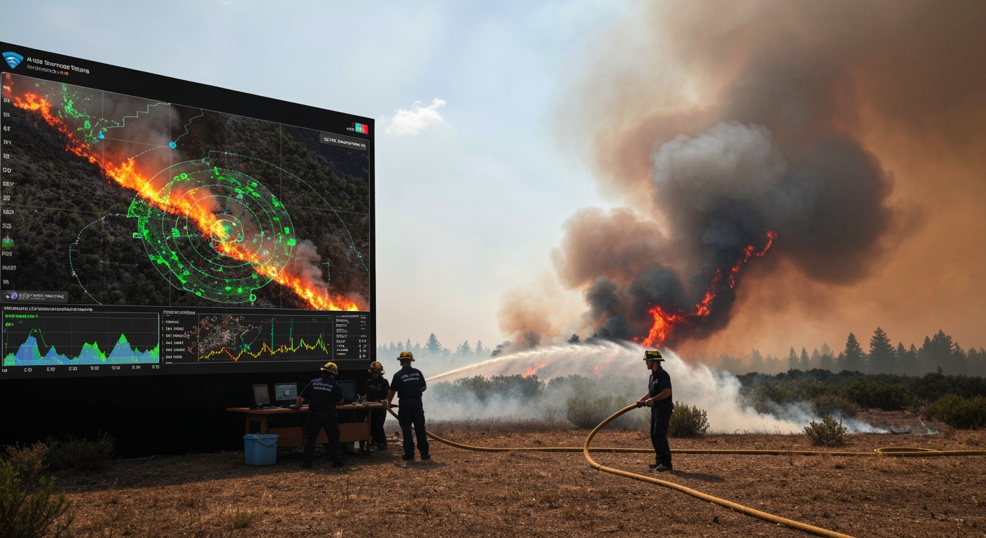
The escalating threat of wildfires, intensified by a changing climate, demands innovative solutions to protect communities, ecosystems, and infrastructure. As these blazes grow more frequent, intense, and unpredictable, humanity is turning to the farthest reaches of space and the frontiers of artificial intelligence to gain a critical advantage. Advanced satellite constellations coupled with sophisticated AI algorithms are no longer futuristic concepts but indispensable tools, transforming every stage of wildfire management from initial spark detection to post-fire recovery.
Eyes in the Sky: Unprecedented Surveillance and Early Detection
Satellites provide an unparalleled vantage point, offering constant and broad monitoring across vast, often inaccessible, landscapes. This "eye in the sky" capability is crucial for identifying fires in their nascent stages, a critical factor given that every minute saved in detection can drastically reduce damage and improve containment prospects. Traditional ground-based sensors and human observation, while still valuable, are often limited by terrain, infrastructure, and visibility. Satellites transcend these limitations, scanning immense areas without requiring local maintenance.
The technology in orbit includes various satellite types, each contributing unique capabilities. Geostationary Operational Environmental Satellites (GOES-R Series), for instance, maintain a continuous watch over a single region, delivering near real-time, high-resolution images. These instruments excel at detecting heat signatures, mapping fire perimeters, assessing fire size and temperature, and tracking hazardous smoke plumes to gauge air quality and health risks. Polar-orbiting satellites, such as those in the Joint Polar Satellite System (JPSS) equipped with the Visible Infrared Imaging Radiometer Suite (VIIRS), offer detailed global coverage and are particularly adept at detecting smaller, lower-temperature fires with a spatial resolution of 375 meters, even enhancing nighttime detection capabilities.
A new generation of satellite constellations is emerging, purpose-built for wildfire surveillance. The FireSat constellation, with its first operational satellites launched in July 2026, is specifically designed for wildfire detection and monitoring. These satellites are equipped with multispectral infrared payloads capable of identifying fires as small as 25 square meters (5x5 meters) through smoke and clouds, providing updates every 20 minutes or less. This level of precision and frequency drastically improves the chances of early intervention before a small fire escalates into a catastrophic event. Further advancements, such as the Wildfire-applicable Intelligent and Responsive Ensemble for Detection and Scheduling (WildFIRE-DS) developed by West Virginia University engineers, enable satellites to not only detect fires but also automatically reposition and coordinate with one another, allowing them to revisit newly detected hotspots more frequently and maintain continuous observation as fires evolve.
Despite these remarkable strides, challenges persist. Traditional satellites can struggle with detecting very small fires, and delays in data downlink and processing, sometimes up to 90 minutes, can hinder rapid response. Cloud cover and thick smoke can also obscure fire signals, limiting detection effectiveness. However, ongoing research is addressing these limitations, with AI playing a crucial role in enhancing satellite data interpretation and mitigating environmental interferences.
The Brain Behind the Blaze: AI for Prediction and Analysis
Where satellites provide the "eyes," artificial intelligence offers the "brain," processing colossal amounts of data to predict wildfire behavior, assess risks, and analyze conditions with unprecedented speed and accuracy. AI systems integrate diverse datasets, including satellite imagery, real-time weather forecasts, topographical maps, vegetation types, fuel moisture levels, and historical fire patterns. This comprehensive analysis allows for dynamic modeling that can anticipate fire spread and intensity in ways previously unimaginable.
One critical application of AI is in refining fuel maps, which are essential for accurate fire behavior prediction. Historically, collecting this information has been time-consuming and inefficient, relying on manual ground observations that often result in outdated data. AI models, however, can rapidly process satellite data—such as Sentinel-1's surface texture information and Sentinel-2's plant health indicators—to accurately update fuel maps in minutes. This allows for precise identification of vegetation types and conditions, including dead timber, which can significantly accelerate fire spread. During the East Troublesome Fire, an AI model accurately updated fuel data, enabling a fire simulation to predict the burned area with far greater accuracy than models using unadjusted datasets. Systems like UCLA's FuelVision further enhance this by using satellite imagery and AI to map fuel loads with an accuracy rate of 77%.
AI is also revolutionizing early fire detection on the ground. Beyond satellite heat signatures, AI continuously analyzes images from thousands of ground-based cameras, like the over 1,100 cameras deployed in California, looking for tell-tale smoke plumes. NOAA's Next Generation Fire System (NGFS) exemplifies this, using AI to scan satellite imagery for heat anomalies and issuing alerts in as little as one minute for fires as small as a quarter-acre. This rapid alert system significantly improves initial attack success rates, with early analyses showing that quick firefighter response aided by NGFS saved over $850 million worth of structures and property during a recent Oklahoma wildfire outbreak.
Furthermore, AI-powered predictive models offer real-time forecasts of a fire's path, intensity, and growth rate, often within minutes rather than hours. This capability was dramatically demonstrated during the 2020 Valley Fire in San Diego County, where an AI platform provided dynamic forecasts every 15 minutes, allowing emergency operations centers to issue preemptive evacuation warnings and stage fire crews more effectively. This critical head start, even if just 30 minutes, can save lives and prevent millions in property damage. Researchers are also developing tools like TankerVision, which uses AI to predict fire evolution hours into the future, further aiding resource allocation and evacuation planning.
Optimizing the Response: From Data to Deployment
The integration of AI and satellite data extends directly to optimizing emergency response and resource deployment. The actionable intelligence derived from these technologies allows firefighting agencies to make smarter, more informed decisions under intense pressure. By providing a clear, continuously updated picture of a wildfire's behavior and potential trajectory, AI helps incident commanders strategically allocate limited firefighting resources, from ground crews to aerial assets.
Predictive models not only guide suppression efforts but also enhance firefighter safety. Knowing where a fire is likely to spread, how quickly, and with what intensity allows for safer planning of attack strategies and placement of personnel. The ability to stay "one step ahead of the fire" is paramount in dynamic and dangerous environments. These insights directly inform evacuation orders, ensuring that communities at risk receive timely warnings and that evacuation routes are clear and safe.
Beyond the Inferno: Recovery and Prevention
The utility of AI and satellite technology transcends the active firefighting phase, playing a crucial role in post-fire assessment and long-term prevention strategies. Once a fire has passed, satellites are instrumental in mapping burned areas, assessing the severity of the damage, and monitoring the environmental impact. They track smoke and pollutants to evaluate air quality and health risks for affected populations.
High-resolution satellite imagery, combined with AI-driven classification algorithms, can accurately determine the extent of burn scars and even assess building damage. This information is vital for first responders, government agencies, and insurance companies to estimate costs, allocate recovery aid, and plan for reconstruction. Specialized dashboards can integrate satellite data with Geographic Information System (GIS) technology to provide rapid, 3D damage assessments, filling critical information gaps, especially when traditional aerial surveys are grounded due to adverse conditions.
In the longer term, satellites monitor ecosystem recovery by tracking vegetation regrowth through various indices, such as the Normalized Difference Vegetation Index (NDVI) and Normalized Burn Ratio (NBR). This helps understand the long-term impact of wildfires and guides reforestation and land rehabilitation efforts. For prevention, AI analyzes historical data alongside current environmental conditions to identify high-risk areas prone to future ignitions, enabling proactive measures like targeted fuel reduction programs. The creation of "digital twins" – virtual models of landscapes – allows researchers to simulate different wildfire scenarios, further refining prevention strategies and emergency preparedness.
A Future Forged in Data
The fusion of artificial intelligence and satellite technology is fundamentally reshaping humanity's approach to wildfires. From rapid detection and precise predictive modeling to optimized response and informed recovery efforts, these tools are providing critical advantages in a battle that is increasingly complex and urgent. While challenges such as data latency, sensor limitations, and the need for continuous model refinement remain, the ongoing advancements promise a future where technology empowers humanity to mitigate the devastating impacts of wildfires with greater efficiency, safety, and foresight. This evolving synergy between space-based observation and advanced computational intelligence represents a beacon of hope in safeguarding communities and natural environments against an ever-present and growing threat.
Related Articles


The Regulatory Maze: Why Taming Social Media Harms Remains an Elusive Quest
The digital public square, once heralded as a beacon of connection and information, has increasingly become a battleground rife with misinformation, hate speech, cyberbullying, and threats to mental health. Despite...


Gamescom 2026: Industry Thrives Amid Record Success, Grapples with AI's Transformative Power
COLOGNE, GERMANY – Gamescom 2026, the world's largest video game trade fair, concluded its latest edition with resounding success, demonstrating the enduring vitality and economic strength of the global gaming industry....


Volkswagen's Defining Moment: Restructuring Talks Poise to Reshape German Automotive Landscape
Wolfsburg, Germany – Europe's largest automaker, Volkswagen, stands at a critical juncture, facing what its CEO, Oliver Blume, has termed a "more than critical" situation. Intense internal discussions, dubbed "crunch...